

06-15-2021 Portsmouth, Hampshire, UK, Okeene Oklahoma USA shown on a Geography map or road map
Коллекция по умолчанию
Коллекция по умолчанию
Создать новую

Red clerical needle on a map of the USA, Arizona and the capital Phoenix. Close up map of orizona with red tack, US map pin
Коллекция по умолчанию
Коллекция по умолчанию
Создать новую

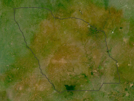
Kgalagadi, district of Botswana. Low resolution satellite maps
Коллекция по умолчанию
Коллекция по умолчанию
Создать новую

Vector illustration map Oklahoma is one of the states of America isolated on a white backgroundŒ
Коллекция по умолчанию
Коллекция по умолчанию
Создать новую

Oklahoma state of United States flag textile cloth fabric waving on the top sunrise mist fog
Коллекция по умолчанию
Коллекция по умолчанию
Создать новую

Red tack in a map of Kansas City, Kansas
Коллекция по умолчанию
Коллекция по умолчанию
Создать новую
Savannah city in Georgia. USA cityscape at sunset
Коллекция по умолчанию
Коллекция по умолчанию
Создать новую

State of Oklahoma. Map of Oklahoma. United States of America Oklahoma. State maps. Vector illustration
Коллекция по умолчанию
Коллекция по умолчанию
Создать новую

mauritania map on a old vintage crack paper background
Коллекция по умолчанию
Коллекция по умолчанию
Создать новую

October 7th, 2015 - Montreal, Canada. Old 1940s Webster's Dictionary United States of America Map Close-up
Коллекция по умолчанию
Коллекция по умолчанию
Создать новую

Oklahoma City, Oklahoma on an old torn map from 1949, isolated. Part of the old map series.
Коллекция по умолчанию
Коллекция по умолчанию
Создать новую

Sacramento skyline in California
Коллекция по умолчанию
Коллекция по умолчанию
Создать новую

Kgalagadi, district of Botswana. Low resolution satellite map
Коллекция по умолчанию
Коллекция по умолчанию
Создать новую
North Kurdufan, state of Sudan. Low resolution satellite maps
Коллекция по умолчанию
Коллекция по умолчанию
Создать новую

Oklahoma map. Poster with map of the us state in retro color palette. Shape of Oklahoma with sunburst rays background. Vector illustration.
Коллекция по умолчанию
Коллекция по умолчанию
Создать новую

Map of South Dakota
Коллекция по умолчанию
Коллекция по умолчанию
Создать новую

3D Montana (USA) Grunge Blueprint map with shadow
Коллекция по умолчанию
Коллекция по умолчанию
Создать новую

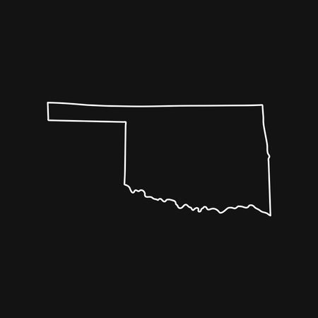
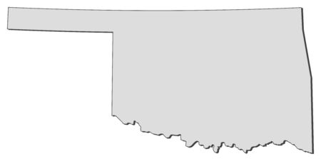
Map of Oklahoma
Коллекция по умолчанию
Коллекция по умолчанию
Создать новую

Map of Wallace in Kansas
Коллекция по умолчанию
Коллекция по умолчанию
Создать новую

map of rhode island state on a old vintage crack paper background with compass
Коллекция по умолчанию
Коллекция по умолчанию
Создать новую

Black highlighted location map of the Craig County inside gray administrative map of the Federal State of Oklahoma, USA
Коллекция по умолчанию
Коллекция по умолчанию
Создать новую

Map of Adair in Oklahoma
Коллекция по умолчанию
Коллекция по умолчанию
Создать новую

Kgalagadi, district of Botswana. High resolution satellite maps
Коллекция по умолчанию
Коллекция по умолчанию
Создать новую

Black highlighted location map of the Tillman County inside gray administrative map of the Federal State of Oklahoma, USA
Коллекция по умолчанию
Коллекция по умолчанию
Создать новую

05-17-2021 Portsmouth, Hampshire, UK, Hastings Minnesota USA shown on a Geography map or road map
Коллекция по умолчанию
Коллекция по умолчанию
Создать новую

Map of Oklahoma
Коллекция по умолчанию
Коллекция по умолчанию
Создать новую

Ramadan Oklahoma With Cannon
Коллекция по умолчанию
Коллекция по умолчанию
Создать новую
Oklahoma map on black background
Коллекция по умолчанию
Коллекция по умолчанию
Создать новую

Shape of La Pampa, province of Argentina, with its capital isolated on a solid color background. Satellite imagery. 3D rendering
Коллекция по умолчанию
Коллекция по умолчанию
Создать новую

Red clerical needle on a map of USA, South Alabama and the capital Montgomery. Close up map of South Alabama with red tack, United States map pin USA
Коллекция по умолчанию
Коллекция по умолчанию
Создать новую

Black highlighted location map of the Sequoyah County inside gray administrative map of the Federal State of Oklahoma, USA
Коллекция по умолчанию
Коллекция по умолчанию
Создать новую

Map of Oklahoma
Коллекция по умолчанию
Коллекция по умолчанию
Создать новую

Black highlighted location map of the Logan County inside gray administrative map of the Federal State of Oklahoma, USA
Коллекция по умолчанию
Коллекция по умолчанию
Создать новую
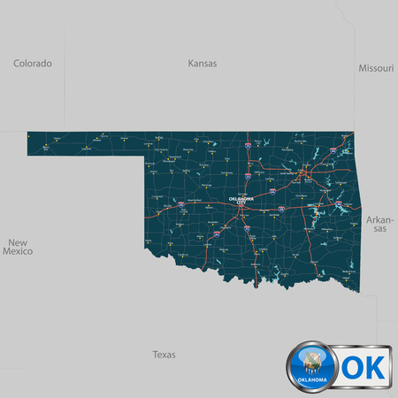
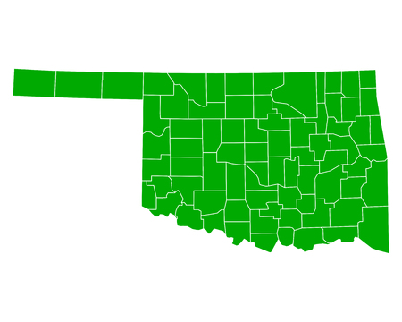
Vector set of Oklahoma state with roads map, cities and neighboring states
Коллекция по умолчанию
Коллекция по умолчанию
Создать новую

Collines, department of Benin. Elevation map colored in wiki style with lakes and rivers
Коллекция по умолчанию
Коллекция по умолчанию
Создать новую

Low key picture of a fist painted in colors of american state flag of oklahoma
Коллекция по умолчанию
Коллекция по умолчанию
Создать новую

An aerial view of the Greensboro, North Carolina skyline
Коллекция по умолчанию
Коллекция по умолчанию
Создать новую

Map of Ness in Kansas
Коллекция по умолчанию
Коллекция по умолчанию
Создать новую

Louisiana, state of United States of America. Grayscale elevation map with lakes and rivers. Locations and names of major cities of the region. Corner auxiliary location maps
Коллекция по умолчанию
Коллекция по умолчанию
Создать новую

Black highlighted location map of the Bryan County inside gray administrative map of the Federal State of Oklahoma, USA
Коллекция по умолчанию
Коллекция по умолчанию
Создать новую

U.S. states - map of Oklahoma. Hand made. Rivers and lakes are shown. Please look at my other images of cartographic series - they are all very detailed and carefully drawn by hand WITH RIVERS AND LAKES.
Коллекция по умолчанию
Коллекция по умолчанию
Создать новую

OKLAHOMA road sign against clear blue sky
Коллекция по умолчанию
Коллекция по умолчанию
Создать новую

Dotted and Silhouette North Dakota map
Коллекция по умолчанию
Коллекция по умолчанию
Создать новую

Map of Colorado
Коллекция по умолчанию
Коллекция по умолчанию
Создать новую

Svay Rieng, province of Cambodia. High resolution satellite maps
Коллекция по умолчанию
Коллекция по умолчанию
Создать новую

Two versions of the map of US State Oklahoma, with the flag of Oklahoma and highlighted in dark grey. Vector map.
Коллекция по умолчанию
Коллекция по умолчанию
Создать новую

Gagauzia, autonomous territory of Moldova. Low resolution satellite maps
Коллекция по умолчанию
Коллекция по умолчанию
Создать новую
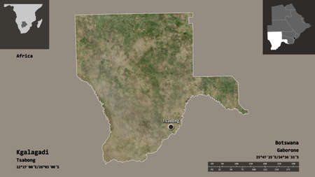
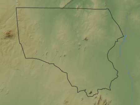
Shape of Kgalagadi, district of Botswana, and its capital. Distance scale, previews and labels. Satellite imagery. 3D rendering
Коллекция по умолчанию
Коллекция по умолчанию
Создать новую

South Dakota state map with long shadow
Коллекция по умолчанию
Коллекция по умолчанию
Создать новую

Political map of United States with the several states where Texas is highlighted.
Коллекция по умолчанию
Коллекция по умолчанию
Создать новую
Botswana area map in the Azimuthal Equidistant projection. bilevel elevation map. Full composition of rasters with borders, main cities, capital name and graticule
Коллекция по умолчанию
Коллекция по умолчанию
Создать новую

Map of Sequoyah in Oklahoma
Коллекция по умолчанию
Коллекция по умолчанию
Создать новую
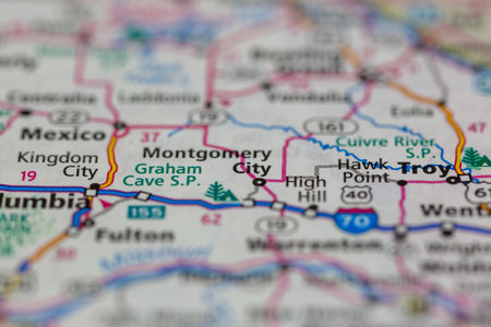
05-18-2021 Portsmouth, Hampshire, UK, Montgomery City Missouri USA shown on a Geography map or road map
Коллекция по умолчанию
Коллекция по умолчанию
Создать новую
Zou, department of Benin. Low resolution satellite maps
Коллекция по умолчанию
Коллекция по умолчанию
Создать новую

Arad, county of Romania. High resolution satellite maps
Коллекция по умолчанию
Коллекция по умолчанию
Создать новую

El Paso, Texas, USA downtown city skyline at dusk with Juarez, Mexico in the distance.
Коллекция по умолчанию
Коллекция по умолчанию
Создать новую

Aerial view of the Boulder city space, Colorado
Коллекция по умолчанию
Коллекция по умолчанию
Создать новую
North Kurdufan, state of Sudan. Colored elevation map with lakes and rivers
Коллекция по умолчанию
Коллекция по умолчанию
Создать новую

Topographic Relief Peaks and Valleys Map of US Federal State of Oklahoma
Коллекция по умолчанию
Коллекция по умолчанию
Создать новую

Kavango West, region of Namibia. High resolution satellite map
Коллекция по умолчанию
Коллекция по умолчанию
Создать новую

Map of Tillman in Oklahoma
Коллекция по умолчанию
Коллекция по умолчанию
Создать новую

Close-Up map of Billings, Montana
Коллекция по умолчанию
Коллекция по умолчанию
Создать новую

Three-dimensional map of Kansas. USA. 3d
Коллекция по умолчанию
Коллекция по умолчанию
Создать новую

Highly detailed editable political map with separated layers. Oklahoma.
Коллекция по умолчанию
Коллекция по умолчанию
Создать новую

Slovakia. Neighborhood - distant perspective with outline of the country. satellite imagery
Коллекция по умолчанию
Коллекция по умолчанию
Создать новую

The national flag of the United States and symbolism of each of the states.
Коллекция по умолчанию
Коллекция по умолчанию
Создать новую

McLaughlin, South Dakota is the largest town on the Standing Rock Native American Reservation
Коллекция по умолчанию
Коллекция по умолчанию
Создать новую
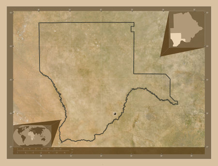
Kgalagadi, district of Botswana. Low resolution satellite map. Corner auxiliary location maps
Коллекция по умолчанию
Коллекция по умолчанию
Создать новую
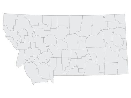
Gray Map on White Background of Counties of USA Federal State of Montana
Коллекция по умолчанию
Коллекция по умолчанию
Создать новую

Detailed map of Armstrong county in Texas, United States
Коллекция по умолчанию
Коллекция по умолчанию
Создать новую

Red clerical needle on a map of USA, Illinois and the capital Springfield. Close up map of Illinois with red tack
Коллекция по умолчанию
Коллекция по умолчанию
Создать новую

Savannah, region of Ghana. Open Street Map. Locations and names of major cities of the region. Corner auxiliary location maps
Коллекция по умолчанию
Коллекция по умолчанию
Создать новую

Three-dimensional map of Mississippi. USA. 3d
Коллекция по умолчанию
Коллекция по умолчанию
Создать новую
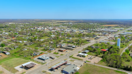
Expansive aerial view small town layout, featuring houses, roads, surrounding greenery on American small town
Коллекция по умолчанию
Коллекция по умолчанию
Создать новую

United States with selected Oklahoma map and Oklahoma flag icon. Vector map and flag.
Коллекция по умолчанию
Коллекция по умолчанию
Создать новую

Map of Texas on rusty metal
Коллекция по умолчанию
Коллекция по умолчанию
Создать новую

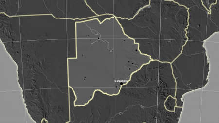
Map of Botswana
Коллекция по умолчанию
Коллекция по умолчанию
Создать новую
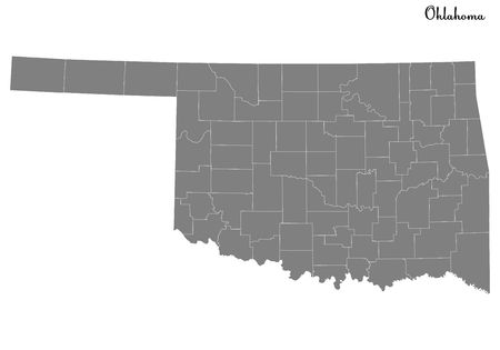
High Quality map of Oklahoma is a state of United States with borders of the counties
Коллекция по умолчанию
Коллекция по умолчанию
Создать новую

Oklahoma on USA map with map of the state
Коллекция по умолчанию
Коллекция по умолчанию
Создать новую

Aerial view of fields and meadows during a summer day
Коллекция по умолчанию
Коллекция по умолчанию
Создать новую

Collines, department of Benin. Elevation map colored in wiki style with lakes and rivers
Коллекция по умолчанию
Коллекция по умолчанию
Создать новую

Vilnius, Lithuania, Europe. Sunset Cityscape. Modern Office Buildings Skyscrapers In Business District New City Center Shnipishkes In Night Illuminations
Коллекция по умолчанию
Коллекция по умолчанию
Создать новую
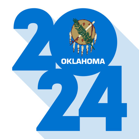
2024 long shadow banner with Oklahoma state flag inside. Vector illustration.
Коллекция по умолчанию
Коллекция по умолчанию
Создать новую

Shooting in Texas
Коллекция по умолчанию
Коллекция по умолчанию
Создать новую
Map of Oklahoma, a state of United States.
Коллекция по умолчанию
Коллекция по умолчанию
Создать новую

A Map of the the United States of America with 1 state selected - Oklahoma
Коллекция по умолчанию
Коллекция по умолчанию
Создать новую
Map of Oklahoma
Коллекция по умолчанию
Коллекция по умолчанию
Создать новую
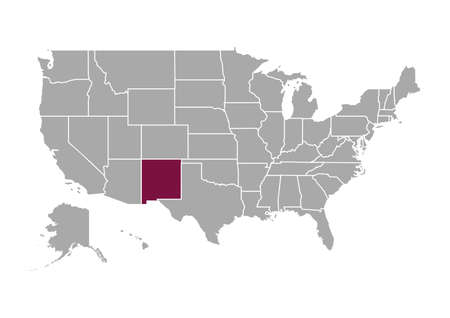
Map of New Mexico state and position in the United States
Коллекция по умолчанию
Коллекция по умолчанию
Создать новую

Three-dimensional map of Indiana. USA. 3d
Коллекция по умолчанию
Коллекция по умолчанию
Создать новую

McLaughlin, South Dakota is the largest town on the Standing Rock Native American Reservation
Коллекция по умолчанию
Коллекция по умолчанию
Создать новую

Black map of the State of North Dakota - vector illustration. Simple flat map State of North Dakota.
Коллекция по умолчанию
Коллекция по умолчанию
Создать новую

Map of Johnston in Oklahoma
Коллекция по умолчанию
Коллекция по умолчанию
Создать новую

Map of Montana - USA
Коллекция по умолчанию
Коллекция по умолчанию
Создать новую

Ohio Red State Map OH Word Name 3d Illustration
Коллекция по умолчанию
Коллекция по умолчанию
Создать новую

Map of Harmon in Oklahoma
Коллекция по умолчанию
Коллекция по умолчанию
Создать новую

Map of Cheyenne in Kansas
Коллекция по умолчанию
Коллекция по умолчанию
Создать новую

Kedougou, region of Senegal. High resolution satellite maps
Коллекция по умолчанию
Коллекция по умолчанию
Создать новую

Map of Grant in Oklahoma
Коллекция по умолчанию
Коллекция по умолчанию
Создать новую

Large and detailed map and info about Marion County in Alabama
Коллекция по умолчанию
Коллекция по умолчанию
Создать новую
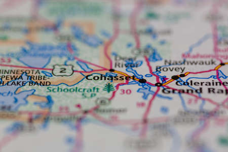
05-17-2021 Portsmouth, Hampshire, UK, Cohasset Minnesota USA shown on a Geography map or road map
Коллекция по умолчанию
Коллекция по умолчанию
Создать новую
Legion-Media
Создайте свои проекты на основе качественных стоковых фотографий и видео.


Copyright © Legion-Media.